Deep Time · II

Biogeochemistry of the Aegean

From a subducting plate to dissolved oxygen — five layers of process that meet at the Kriopigi shore.

Back to Geology

Tectonic foundation

A subducting plate beneath the sea

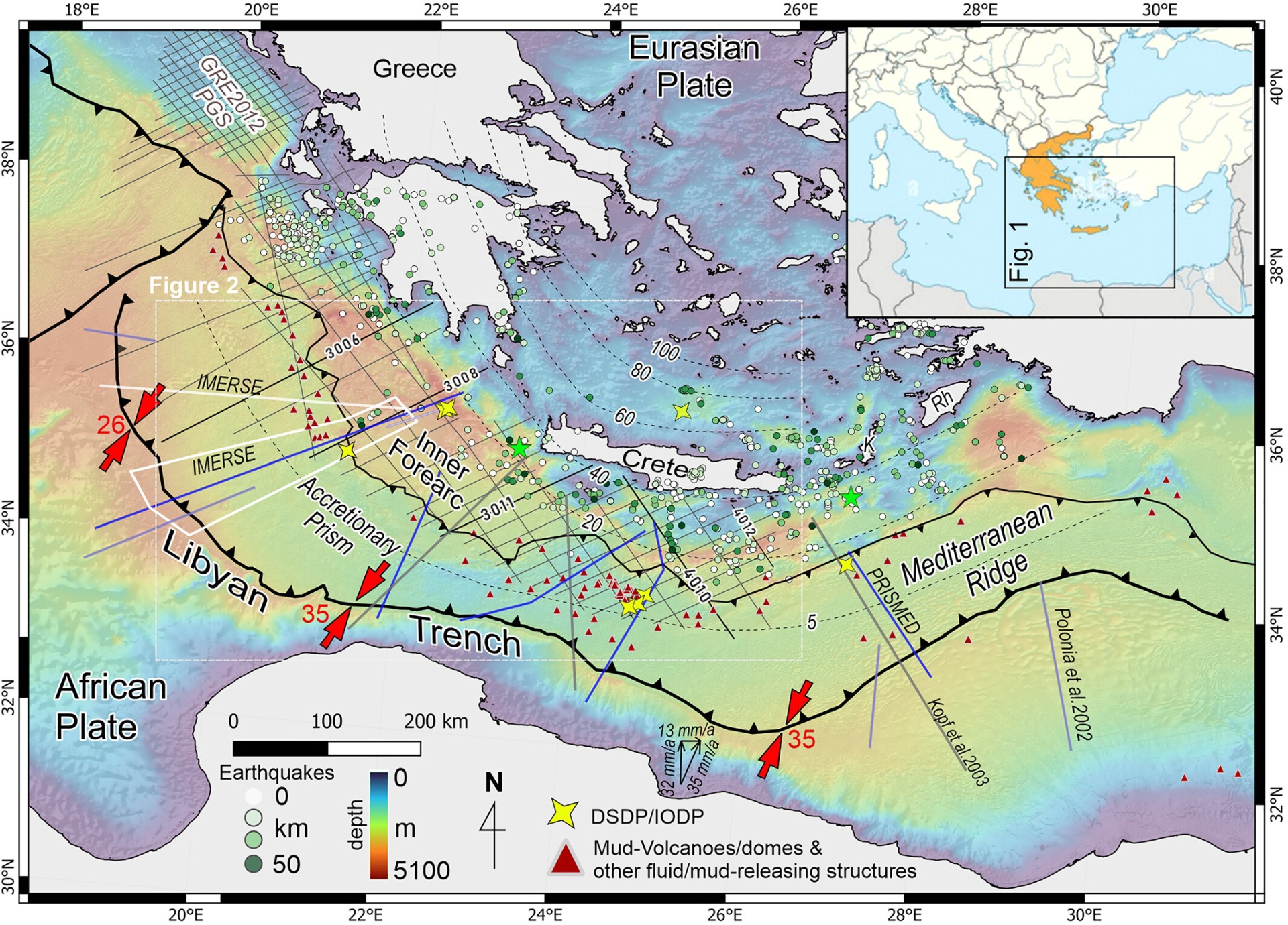
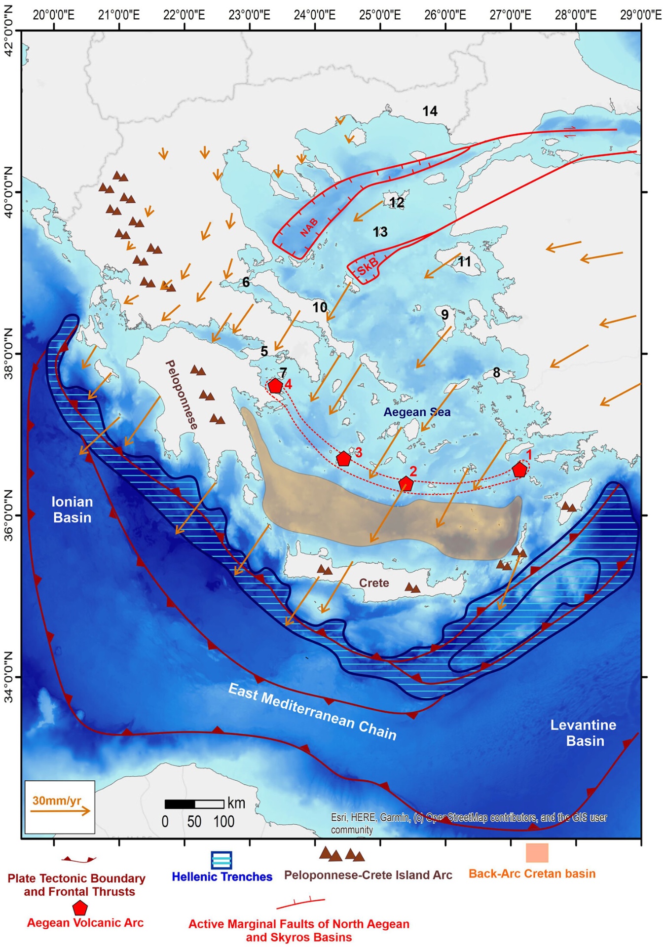
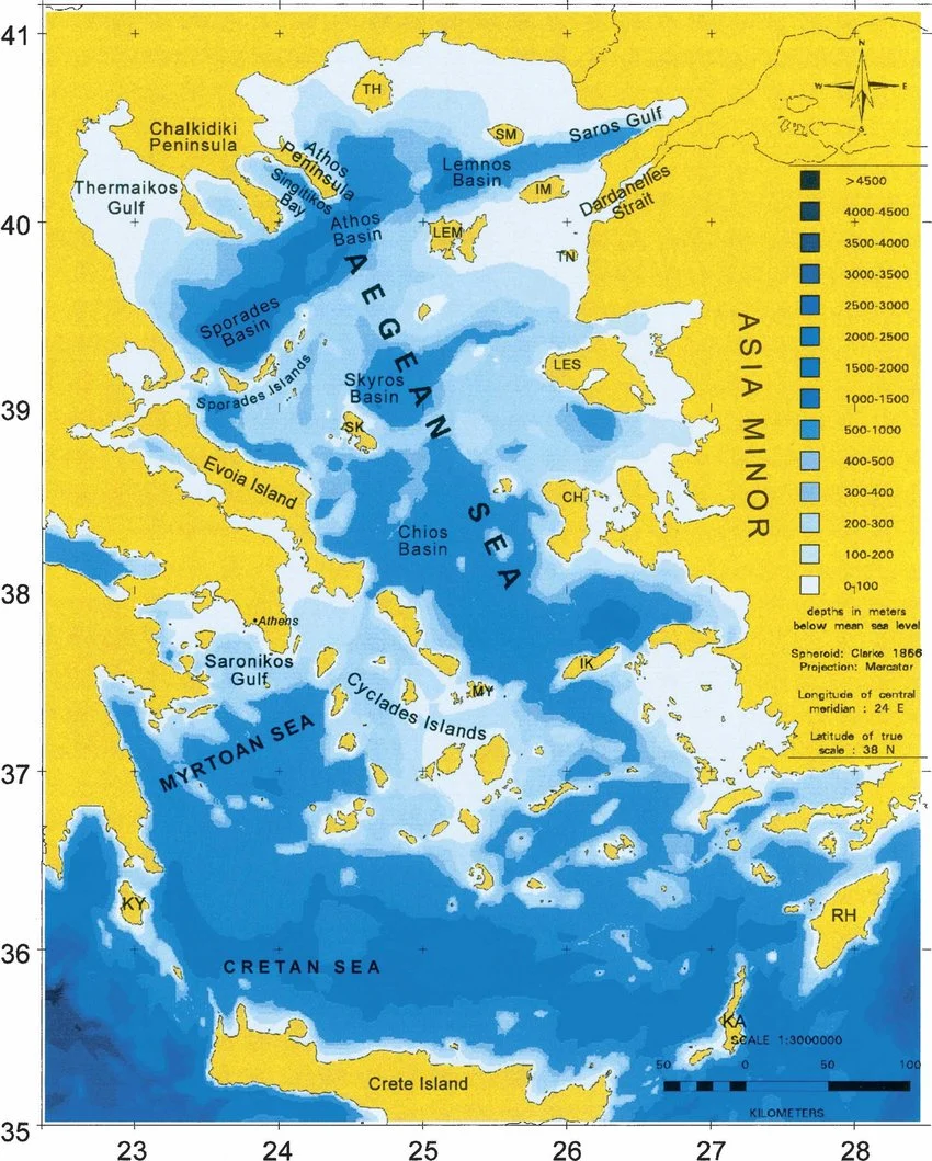
The Aegean sits above the Hellenic Subduction System, where the African plate dives beneath Eurasia along a curved trench south of Crete. This slow plunge — only a few centimetres per year — drives every younger feature on this page: the basins, the volcanoes, the deep currents, and ultimately the chemistry of the water column.

Map of the Hellenic Subduction System in the Eastern Mediterranean showing trenches, earthquakes and mud volcanoes
The Hellenic Subduction System in the Eastern Mediterranean. After Mouslopoulou et al. (2025), Tectonics 44, e2025TC008943.

Back-arc extension

Graben, volcanoes, and a stretched crust

Behind the arc, the Aegean crust pulls apart. The North Aegean and Skyros basins open as tectonic graben, while the volcanic arc — Methana, Milos, Santorini, Nisyros — punches through the thinned crust. This extensional architecture sets the depth and shape of every basin water mass that follows.

Map of tectonic graben and volcanism in the Aegean, Greece
Active tectonic graben and the Aegean volcanic arc. After Papanikolaou, Nomikou & Lampridou (2025), 'Tectonic graben and volcanism in the Aegean, Greece', Geological Society, London, Special Publications 560.

Bathymetry

The basins water settles into

Tectonics and erosion together carved a complex bottom: the deep North Aegean trough, the Athos and Sporades basins, the Chios and Skyros depressions. Halkidiki sits at the rim — a shallow shelf flanking the Athos Basin — which is why local circulation is so sensitive to the deep flows arriving from the south.

Bathymetric map of the Aegean Sea showing major basins
Bottom topography of the Aegean Sea. Map adapted from Karageorgis (1995).

Surface circulation

How water moves through the Aegean

Cool, fresher Black Sea water enters from the Dardanelles and sweeps west and south along the Greek coast; warmer, saltier Levantine water pushes north along the Turkish side. The resulting cyclonic and anticyclonic gyres deliver nutrients to the Halkidiki shelf and flush the bays on a seasonal rhythm.

Schematic of Aegean Sea upper circulation
Schematic representation of the Aegean Sea upper circulation (following Theocharis et al., 1993 & 1999; Theocharis & Georgopoulos, 1993; Zodiatis, 1994; Zervakis & Georgopoulos, 2002).

Biogeochemistry

Oxygen, nutrients, and the open Mediterranean

Aegean water that exits south through the Cretan straits feeds Levantine Intermediate Water — the oxygen and nutrient supply for the broader Eastern Mediterranean. The Rhodes Gyre, just downstream, is one of the basin's main 'oxygen pumps' in winter. The chemistry of the water at Kriopigi is one node in this much larger circulation.

Map of dissolved oxygen and circulation in the Levantine Sea
Dissolved oxygen and circulation in the Levantine Basin. From Habib et al. (2026), 'Dissolved oxygen budget in the Levantine Sea: a coupled physical-biogeochemical modelling approach', Biogeosciences 23, 2939–2958, https://doi.org/10.5194/bg-23-2939-2026 (CC BY 4.0).