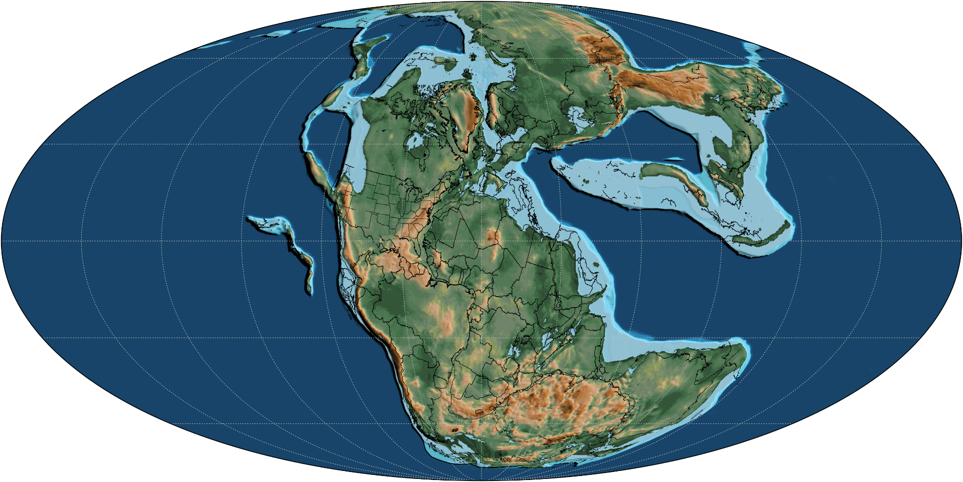
~250 Mya · Triassic
An ancient sea bed
The carbonate platform that would become Halkidiki's bedrock accumulates as marine sediment in the warm Tethys Ocean — countless coral, mollusc, and plankton skeletons compacted into limestone.
Formation
Read downward through time — from a Triassic sea bed to the cold spring that still feeds the bay.
~250 Mya · Triassic
The carbonate platform that would become Halkidiki's bedrock accumulates as marine sediment in the warm Tethys Ocean — countless coral, mollusc, and plankton skeletons compacted into limestone.
~50 Mya · Eocene
The collision of the African and Eurasian plates lifts the Hellenic peninsula. The Kassandra ridge emerges as a long limestone spine, faulted and folded by ongoing compression.
~5 Mya · Pliocene
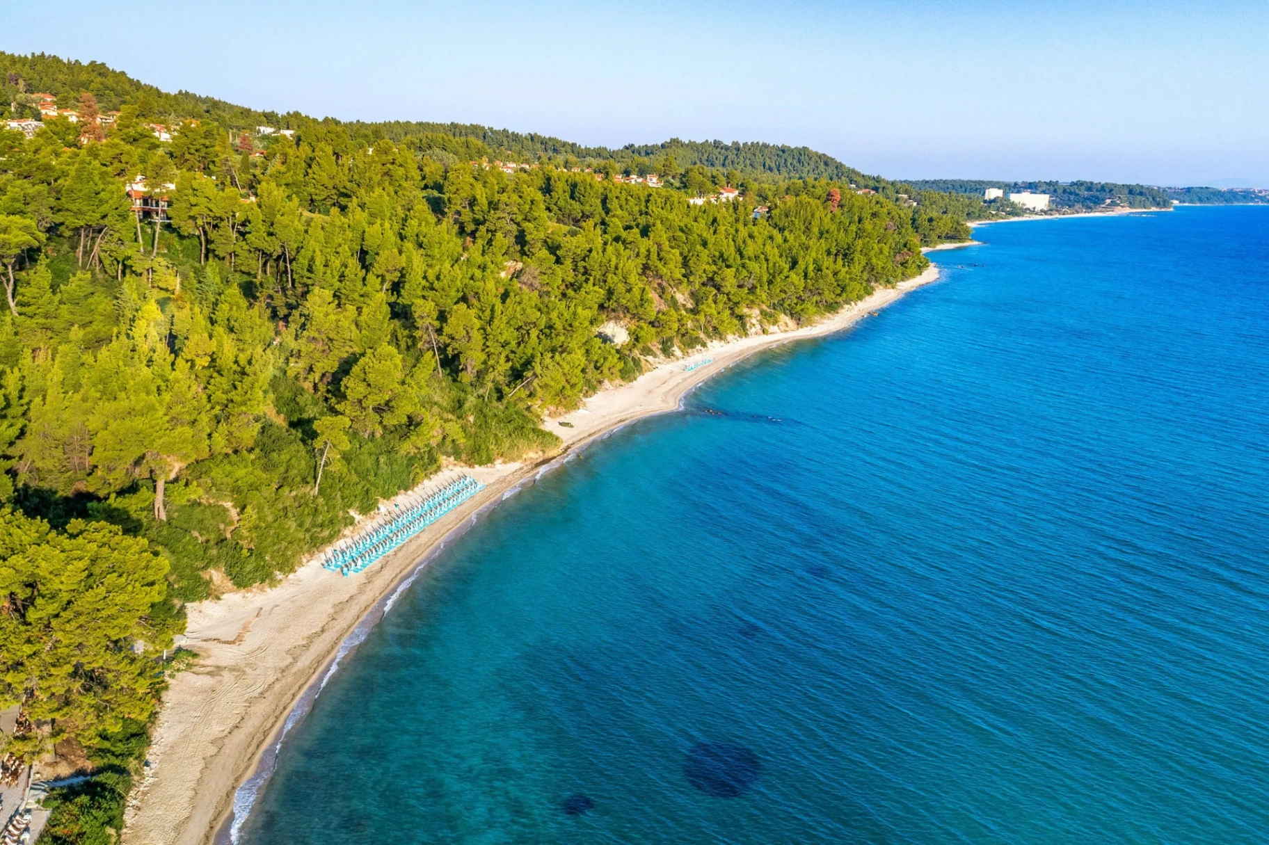
Sea level fluctuations and karst dissolution carve coves and headlands. Freshwater percolating through fractured limestone emerges as cold springs along the shore — krio pigi, the cold spring.
~12,000 ya · Holocene
Post-glacial sea-level rise floods the lower valleys. Aleppo pine (Pinus halepensis) colonises the slopes; Posidonia oceanica meadows establish on the sandy shelf, stabilising the bay.
Today
The cold spring still surfaces beneath the sand, lowering nearshore temperatures by 2–3°C in summer — a microclimate that shelters juvenile fish and keeps the seagrass meadow productive.
Reading the maps
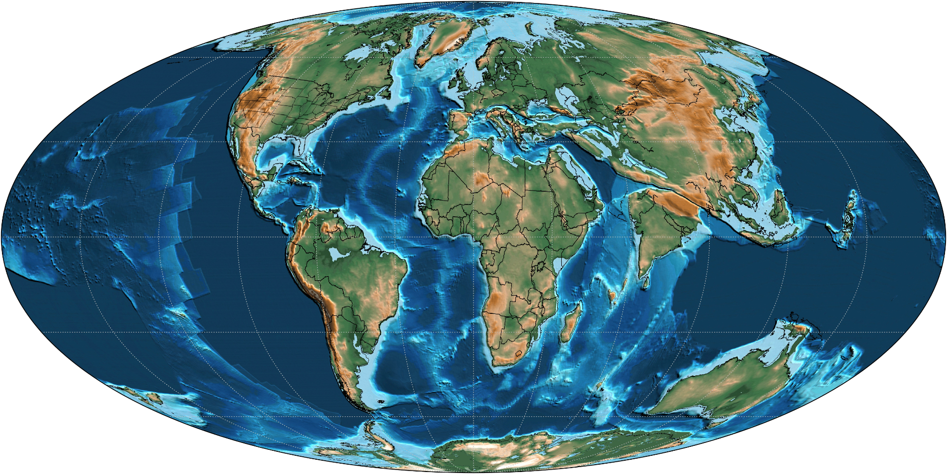
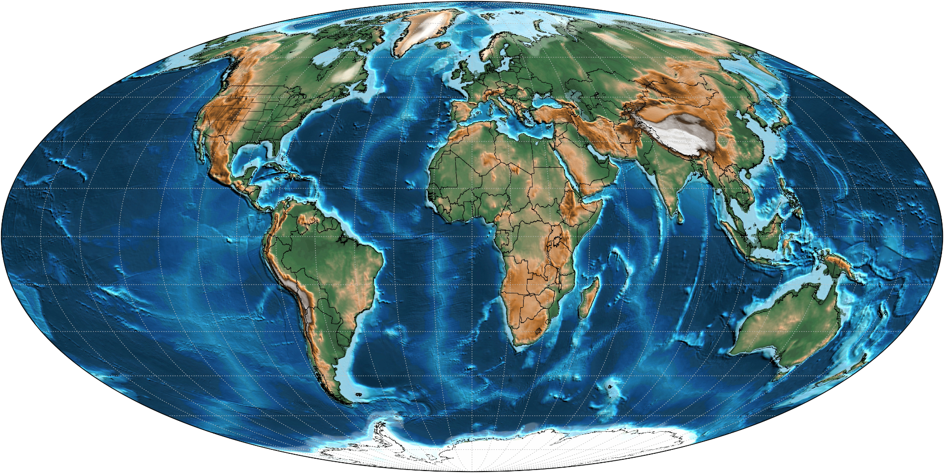
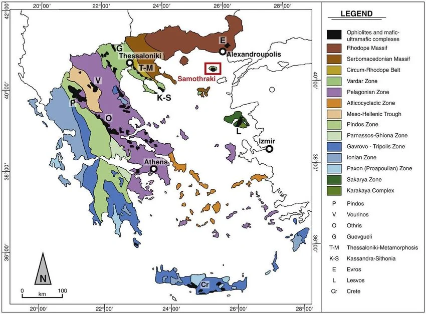
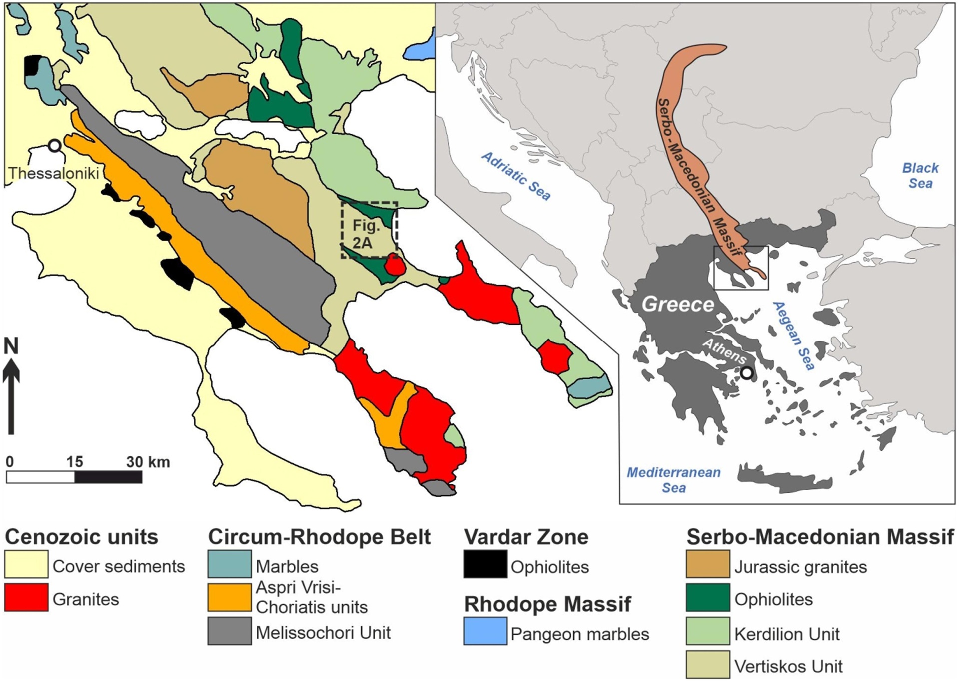
The colored zones above are not decoration — they are different tectonic terranes: chunks of crust with separate origins, compressed and welded together over hundreds of millions of years to build the Hellenides, the Greek mountain system. The Halkidiki peninsulas sit inside that collage, shaped by continental collision, mountain building, uplift, faulting, the closure of an ancient ocean, and erosion. The landscape you walk through is the surface expression of that history.
How geology shapes the coast today
Kassandra is uplifted, faulted terrain — steep slopes, gullies, drainage cuts, ridges, coves, and irregular shorelines. Mediterranean rains often arrive in intense bursts, and winter rainfall, erosion, sediment transport, and slope instability still actively shape it.
Much of the peninsula sits on metamorphic and crystalline basement rocks with weathered rocky substrates. The result is nutrient-poor, thin, drought-prone, fast-draining soil — conditions that favour Aleppo pine, maquis, phrygana, and aromatic shrubs over lush temperate forest. That is why the vegetation reads sparse, resinous, silver-green, and drought-adapted.
Rocky, low-nutrient terrain means little sediment input and limited nutrient runoff. Combined with the oligotrophic conditions of the Aegean, the result is low turbidity and intense clarity — there are no large muddy river systems dumping fines into these shores.
Faults and fractured bedrock channel groundwater. Rain infiltrates the rock and re-emerges as coastal springs, seepage zones, and cold-water upwellings — affecting salinity, temperature, nutrients, fish distribution, and seagrass productivity on a very local scale. Krio pigi — the cold spring — is one of these.
Different geological units weather differently. Within a few hundred metres the coast can shift through rocky shelves, pocket coves, coarse gravel beaches, sandy sections, cliffs, and submerged reefs — each one a readout of the rock beneath, the wave exposure above, and the sediment supply between.
The bigger idea
The forests, shrubs, springs, beach types, erosion patterns, water clarity, and marine habitats around Kriopigi all emerge from the same handful of inputs: rock, tectonics, climate, water movement, and time. Read the coast that way and it stops being scenery — it becomes a system.
Continue · Part II
Click here to learn about the Biogeochemistry of the Aegean.